professional drones
by bathymetry

Equipment
intelligent

Analysis
data

Planning
interventions

Services
Cloud
Practical and smart solutions
Why use UAVs for Bathymetry
Bathymetry is a branch of oceanography that deals with depth measurements
of the seabed, graphic representations and morphological studies, rivers and lakes. It is essential for many applications such as navigation safety, environmental monitoring, fluid dynamics modeling, and industrial site management (dams, quarries, reservoirs).
Bathymetry has many uses in science and industry today; however,obtaining accurate measurements is difficult due to limited resources and outdated technology. Professional drones have made this process much easier by providing timely data on various ocean points.
Eventually, we will reach a point where we can accurately predict dangerous storms.
Bathymetric mapping with drones enables rapid and cost-effective measurement of water depths and sediments.
Easy to transport and deploy, this technology allows it to operate even in places that are difficult to access, dangerous or hostile.
Using drones, bathymetric surveys become 10 times faster and more cost-effective than traditional methods based on ships, boats or unmanned vehicles. The most common method is to connect a GPS device to a specialized drone and send it to the surface. The data from the drone allows the depth and characteristics of the sea to be accurately measured.This includes its temperature, salinity, density, and even its waves and currents.
Specialized Sensors
Drones are equipped with sensors such as echosounders or specially designed sonar systems to accurately measure water depth. Before the drone takes off, a flight plan is programmed into its system. This plan outlines the area to be probed, including the altitude and the path the drone will follow. Once airborne, the drone flies over the surface of the water emitting downward signals. These signals penetrate the water and bounce back to the drone sensor, providing data on water depth at various locations.
Displacement Flexibility
Drones can access remote or difficult-to-access areas that might be challenging for boats or piloted aircraft. Ideal for places of such as steep coastlines, mines, shallow water and places with natural obstacles. It is also suitable for monitoring ponds, lakes and canals without the need for a large water access point. Drones can reach places otherwise inaccessible on foot.
Data Processing
Data collected by the drone are processed using specialized software to create bathymetric maps. This software analyzes depth measurements and generates a detailed three-dimensional map of the underwater terrain.
Analysis and Interpretation: Finally, bathymetric maps can be analyzed to identify features such as underwater structures, depth variations, and contours.
Time saving
Drones can cover large areas quickly, reducing the time needed for survey.Data acquisition is 10 times faster than traditional methods due to the ease of transportation and rapid deployment of drones. Conducting drone surveys eliminates the need for personnel to work in potentially hazardous conditions on the water.
Turnkey Solutions for Bathymetry
We have configured Complete “Turnkey” Solutions for our professional clients.
which include everything you need to be immediately operational in the field and start drawing all the
Advantages of using Professional Drones for Bathymetry.
Aerial surveying with bathymetric drones is not only about the drone.
These are integrated systems, complete with calibrated sensors and precision GPS,
Specific flight planning software and APPs,
Precise workflows, post processing software,
professional training and support.
The benefits of DroneBase's "Mapper" solutions.
Not only Drones but Complete Solutions for Professionals!
Our combos include high-performance professional drones with advanced sensors and software.
Professional systems designed in collaboration with topographers and GIS experts to be
Easy to Use in the Field and Accurate in Post Processing

Effective
All Mapper Kits are designed to acquire large areas better and faster without interrupting work or site activities

Precise
Calibrated sensors up to 61MP combined with IMUs and GNSS RTK and PPK systems ensure the highest level of precision with accuracy down to the centimeter at all times

Safe
Difficult to access or dangerous areas will no longer be a problem with our Mapper solutions always ready to take off in moments, safe and reliable in all conditions

Competitive
The drone photogrammetric survey provides reduced field acquisition time and drastic reduction in post processing time allowing it to be more competitive

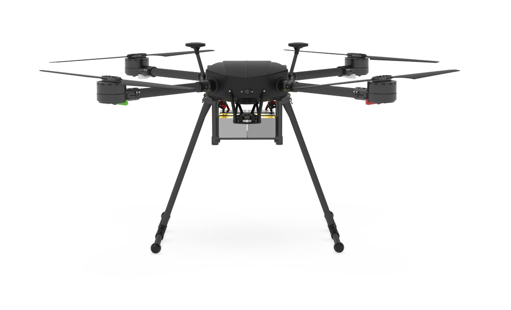
X1000 Pro RTK
Cheaper solution
- X500 Pro RTK
- Additional Battery
- Standard Multispectral Kit - Micasense MX
- RTK Base Antenna - RS2 + Rod and Tripod
- Additional propeller set
- Peli Transport Houses
- UGCS Pro - Professional Flight Planning
- Agisoft Methasape Professional
- Precision Farming Online Course - 8 hours
- Drone Propaedeutic Course - 4 hours
- Gold Technical Support - 5 hours
- Liability + Kasko insurance 12 months
- ENAC Practices and D-Flight Drone Registration
yours from 320.00 Euro/month with grenke operating rental


APPLICATIONS
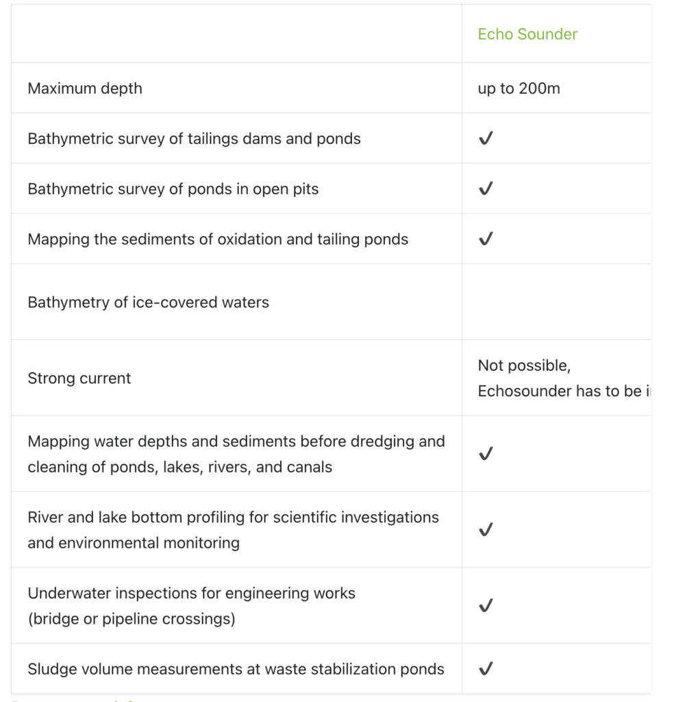
The choice of sensor depends on the technical characteristics and environmental conditions.
Bathymetry with echosounder is suitable for monitoring waste dams and ponds in open pit mines,
as well as for sediment mapping of oxidation and tailing ponds.
Bathymetry with low-frequency GPR is ideal for mapping water depths and sediments
prior to exploitation and cleaning of ponds, lakes, rivers and canals,
as well as for underwater inspection of engineering works such as bridge crossings or pipelines.
HOW IT WORKS.
The integrated drone system for bathymetry includes a drone (UAV) integrated with echosounder or low-frequency GPR. Integration is provided by adding the UgCS SkyHub on-board computer to the system. The addition of a laser altimeter or radar allows the drone to precisely track the terrain during flight. This is all managed through the UgCS software, which plans and controls the flight and visualizes the data collected.
SUPPORTED DRONES AND AUTOPILOTS
Integrated systems can be built using DJI drones such as M300 RTK, M600/M600 Pro (incl. RTK), M210/M210v2 (incl.RTK), as well as custom drones based on DJI A3 or Pixhawk autopilots with ArduCopter/PX4 firmware.
Talk to one of our Experts
DroneBase provides you with an Expert Advisor
Able to recommend the most appropriate product for your needs
And answer all your questions.
Call us NOW!
+39.0541.1790411
Request information
Please enter your details below, our consultant will
will contact back as soon as possible and provide you with all the details!
